
Second and Third Divide Trails
General Information
•Mileage: 7 miles round trip
•Elevation: 3400 to 4400 feet
•Difficulty: Moderate
•Use Level: Light to Moderate
•Season: April to November
Access
In the heart of historic Downieville, follow Upper Main Street for about 0.5 mile and cross the Downie River bridge. Upper Main becomes Lavezzola Road and soon turns to dirt. Continue on the dirt road 2.7 miles to the Second Divide trailhead on the right. To access the Third Divide trailhead, continue another 1.5 miles to a well-defined road fork. Take the right branch, entering Empire Ranch private land, and proceed 0.2 mile to the trailhead sign on the right. Please park your vehicle well off the road and respect the rights of private property owners. Hikers who can arrange transportation may wish to be dropped off at the Third Divide trailhead and hike the loop to their vehicle at Second Divide.
Trail Description
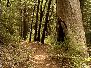
This description covers the loop from Third to Second Divide. A few hundred yards from from the trailhead, the trail crosses Lavezzola Creek and climbs moderately for 2 miles through a beautifully wooded area until it reaches the ridgetop. Another 0.2 miles brings you to the junction with the Second Divide and Butcher Ranch trails. The Second Divide Trail follows Pauley Creek down the canyon. This area has a wide variety of birds, wildlife and flowers. Pauley Creek falls rapidly and the short spur trails leading to the creek are well worth exploring for picnicking, fishing and photography. During mild winters, this trail can be accessed year round.
For a great waterfall hike, take the hike to Loves
Falls.
For an easy family hike, try the Sand
Pond Interpretive Trail.
For a real challenge, there's Sierra
Buttes Lookout.
For a panoramic view, choose the Lakes
Basin Ridge Trail.
For a moderate year-round hike, check out the Canyon
Creek Trail.